Well, we have seen a number of model swings over the past day. We had a good agreement a couple days ago, but that has changed. From rain to snow, from onshore to offshore and from strong to weaker. We have seen models flipping all over the place. What does it all mean? Basically what I think is happening is the models are having a tough time accounting for all the players on the field. Upstream blocking, High pressure, Midwest disturbance etc. Taking those into account and then the timing has a great impact on our storm, or lack thereof.
You can see it here on the Water Vapor loop: Notice the darker area marching towards the "swirl" over GA, thats the disturbance trying to "meet up" with the low pressure.
WATER VAPOR LINK
The low pressure is forming off the GA coast as I write. At the same time, a disturbance is shooting through the midwest and trying to catch and meet up with the low off the GA coast. If this can meet up earlier, we could see a stronger, more inland track. If this misses, or the timing is delayed, we get a weaker, further east solution. For those of us who made it through Sandy, we are all rooting for the weaker, out to sea solution. This has been the trend over the past 16 hours.
Now, if the disturbance can "catch" the low earlier, we will be looking at a more inland track. Not so much inland, but more towards the coastal areas, bringing us a greater impact. The earlier the meeting, the stronger the system, the stronger the winds. And, the earlier they meet up, means a more westward track, meaning we stay a majority of rain (snow back into C PA). The further to the east, the better the chance for snow (in the Jersey area). And obviously, it could go so far east we are not even effected.
These types of storms are always touchy here. We have seen all kinds of outcomes. I will say this, any winds will be bad. Any storm surge now at the coast will be bad. Our area is fragile and any impact will have negative effects. My gut feeling as of now says we get a slop fest. The midday runs are coming up and I think we will know more seeing this fresh new data set. Is the futher east solution still looking good or is it going to have a bigger effect on us....more to come after the midday runs!
Tuesday, November 6, 2012


Sunday, November 4, 2012
Wednesday / Thursday
It appears that we have a decent agreement in the models regarding a potential Nor'easter set to strike an already vulnerable area Wednesday into Thursday. We will have a low pressure develop off the Georgia / South Carolina coast Tuesday which will move north to just off the Cape Hatteras, NC coast. From there, it will move off the Jersey coast and then up into New England. Much like Sandy, this storm will be pushed along the coast because of a "blocking" situation in the upper atmosphere up around Greenland. This will prevent the storm from moving offshore. In addition, it could aid in slowing the storm down over the area, which has shown up in the models.
What this means for us; #1, the shore will once again get battered with winds and flooding rains. In any other circumstance, this would be your run of the mill nor'easter. With the area and many defenses (dunes, sands etc) already ravaged, any storm is a worst case scenario, but this could be worse since it would be a moderate nor'easter. #2 Inland winds on an already fragile electrical system is another disaster waiting to happen. #3, the trees around here are considerably weaker now after Sandy that any more wind could cause a number of them to topple over. #4, Any rain on top of already flooded areas is never a good mix. We may be in for another 12-18 hour period of strong winds.
There are still some variables that need to be worked out, but a consensus is there that we will be effected by a nor'easter. Some of things still to be determined are how close to the coast doest this move, how strong can the storm become and how fast does it move? A tack closer to the coast would bring more of a wind and rain threat inland, as oppose to a further east track which could limit winds inland. Since the storm will develop off the Georgia / SC coast, how strong can it become? This is shown by the pressure. The lower the pressure, the stronger the storm. This is important too because the stronger the storm can get will create a bigger gradient between high and low pressures which will correlate down to us in winds. lower the pressure, greater the winds. and the third wildcard is the blocking. The stronger the block, the slower our storm moves. Models have been showing the storm stalling for a period of time between AC, NJ and NYC/Long Island.
As of now, rain develops Wednesday and will be heavy at times. Winds will kick up as the storm moves closer. I do think this is a rain event. Snows will be confined to Central PA, Poconos and portions of New England (maybe NW NJ as the storm moves away). There will be more to come as the models come in. Quick updates of the models will be posted on twitter @townerswxpage and on my facebook page Towner's Weather PAGE.
What this means for us; #1, the shore will once again get battered with winds and flooding rains. In any other circumstance, this would be your run of the mill nor'easter. With the area and many defenses (dunes, sands etc) already ravaged, any storm is a worst case scenario, but this could be worse since it would be a moderate nor'easter. #2 Inland winds on an already fragile electrical system is another disaster waiting to happen. #3, the trees around here are considerably weaker now after Sandy that any more wind could cause a number of them to topple over. #4, Any rain on top of already flooded areas is never a good mix. We may be in for another 12-18 hour period of strong winds.
There are still some variables that need to be worked out, but a consensus is there that we will be effected by a nor'easter. Some of things still to be determined are how close to the coast doest this move, how strong can the storm become and how fast does it move? A tack closer to the coast would bring more of a wind and rain threat inland, as oppose to a further east track which could limit winds inland. Since the storm will develop off the Georgia / SC coast, how strong can it become? This is shown by the pressure. The lower the pressure, the stronger the storm. This is important too because the stronger the storm can get will create a bigger gradient between high and low pressures which will correlate down to us in winds. lower the pressure, greater the winds. and the third wildcard is the blocking. The stronger the block, the slower our storm moves. Models have been showing the storm stalling for a period of time between AC, NJ and NYC/Long Island.
As of now, rain develops Wednesday and will be heavy at times. Winds will kick up as the storm moves closer. I do think this is a rain event. Snows will be confined to Central PA, Poconos and portions of New England (maybe NW NJ as the storm moves away). There will be more to come as the models come in. Quick updates of the models will be posted on twitter @townerswxpage and on my facebook page Towner's Weather PAGE.
Friday, November 2, 2012
A Look Into Next Week
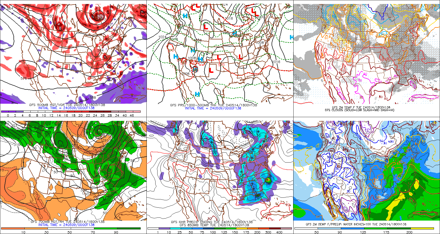
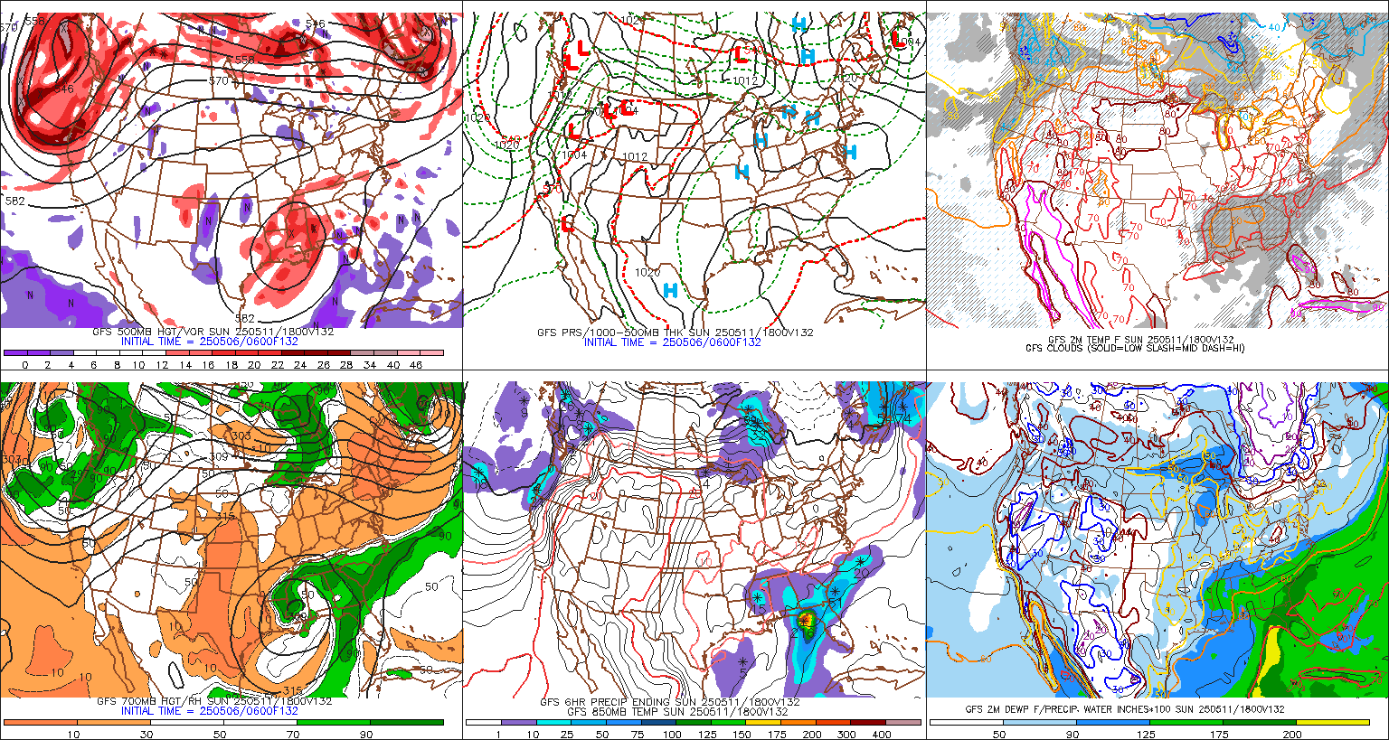
models are once again a buzz with a potential coastal storm for next week. This appears to be the time period from Wednesday through Thursday. The GFS and Euro are still jumping around on solutions, but both show a threat. I will be monitoring it, as any additional storm condition could hamper a lot of the recovery efforts and clean up. More to come. Here are some of the models and what they are showing:
Euro
Noon yesterday:


Euro
Noon yesterday:
Midnight last night:
GFS:
Midnight last night:
Todays morning run:
Subscribe to:
Posts (Atom)