Thursday, February 28, 2013
March 6-7th
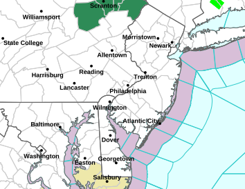
Excuse me as I wake from my winter slumber. As we wind down this disappointing winter, we have a threat on the map. This will be for the period of March 6-7th. The Euro model has shown a system affecting the central midatlantic for a number of days now, and the GFS also has somewhat shown this. As of now, these models show a storm coming from the northwestern states to the midatlantic states. As of now, this looks to be held south of us. More to come.
Friday, February 15, 2013
Friday 2/15/2013 Morning Update
For tonight, expect a possible period of rain showers, snow showers and possible a little light snow to develop. This will not last long and will be out by the morning. Tomorrow, models have trended away from the idea of a coastal storm, so as of now, may be time to cancel the idea of a snowfall for this weekend. Models are keeping this storm pretty far off shore. It will really strengthen once it is beyond us. Eastern New England may get some effects of it, but we should be clear.
If anything changes on it, I will drop a note on here to let you know.
Thursday, February 14, 2013
Recap And The Weekend Ahead
Surface temperatures yesterday during the day really hampered our efforts to get a good accumulating snow. Even when the snow rates increased, it was tough to accumulate due to the surface warmth and the water that had already accumulated on the ground. If we have had that snow a week ago when our highs were in the 20's, we would have had a nice little event. Anyways, time to move on.
I wrote earlier this week about the potential for a storm this weekend. It was being shown on the models a couple days ago, and then went away. Well, the idea of a weekend storm are back. The noon time runs today are showing the potential to be there for our area into the Northeast. These periods of time when multiple storms are showing up on models, it becomes difficult for them to key in on each one. This is one of the reasons why I have felt that it was possible for this weekend, because the positioning of a lot of other elements are present. Sometimes it just takes one storm to conclude before models pick up on the other pieces of energy.
A quick look at the midday model runs has the GFS showing a very nice coastal storm taking shape of the coast in the southeast moving up the coast (moderate storm). The NAM is similar (although not totally honed in yet) and the Canadian model also shows an event like the NAM. The Euro just came out, and has an event, but much lighter. I have not looked at surface temps on each preceding them, but tomorrow is supposed to be warm. In addition, a arctic trough will be settling in just before or concurrent for the storm. Things may get interesting.
I will have more to come over the day and a more detailed post tonight. Just be prepared that a significant storm can potentially come to fruition within a couple days.
Happy Valentines Day to everyone!
Wednesday, February 13, 2013
Wednesday 2/13/2013 Morning Update
Look for precipitation to break out around 7pm. Surface temperatures today will be quite warm, so that is going to limit the amount that accumulates on paved surfaces. This will be more of a nuisance event, especially since there will be little accumulation on pavement. Precipitation moves out around midnight, so its a quick hitter. General accumulations from 2-4" across the area, mostly on grassy surfaces. Once you get north and west of Route 80, precipitation really cuts down.
Still keeping an eye on the weekend, as the potential is still there. Nothing of substance is really showing up, but it will be monitored.
Tuesday, February 12, 2013
Tuesday 2/12/2013 Morning Update
Increasingly more confident of measurable snows moving into the area for Wednesday Night into Thursday. Over the past 24 hours, models have kept the measurable precipitation SOUTH of areas just bombarded (CT, NYC etc). For those areas a coating to 1" can be expected. From NYC South to Trenton 1-2" looks good. From the Trenton area south towards Philly 2-4" is my call, and areas south of that, while seeing more precipitation, you will have serious surface temperature issues preventing a lot of accumulation 1-3" down there. In any case, this looks to be a quick hitter. precipitation moves in between 6pm and 8pm and is out by 7am.
For the weekend there still remains a lot of questions. Most major models are not showing anything resembling a monster storm. The UKMET is probably the closest, but for now remaining cautiously optimistic about the event. More to come on this.
For the weekend there still remains a lot of questions. Most major models are not showing anything resembling a monster storm. The UKMET is probably the closest, but for now remaining cautiously optimistic about the event. More to come on this.
Monday, February 11, 2013
Verification From Blizzard 02/08/2013
Quick Verification from the Blizzard. Always room for improvement,
Predicted Amounts from 2/7/2013
Philly south to NE MD: 1-3"
Philly North to 195 3-6"
195 North to 78 6-10"
78- NYC 10-12"
Lower Hudson Valley - RT 91 in CT 12-20"
RT 91 to East Coast 20-30"
Blog Entry From 2/7/2013
____________________________________________________________________________
Courtesy NWS: Snowfall Map Blizzard 2/8/13-2/9/13

Monday 2/11/2013 Afternoon Update
Wednesdays storm looks a little better today on the weather models. Every major model has precipitation into Central Jersey. The big question is going to be precipitation type. Surface temperatures are looking questionable for the start of the storm. may be one of those situations of a mix to snow. At this point, more focused on the threat of a storm than precip types. Credit to the GFS this storm, it has been onto this for a couple days and it appears other models are moving towards it.
The other aspect which has looked really good on the models this morning is for this weekend. I mentioned this morning about the potential for a potent storm, and it is showing up on models. This storm has some serious potential for the area. The GFS model showed a very nice hit and the Euro has some improving pieces (but not quite there yet). The British UKMET model is all over this already and shows an absolute bomb! Tally ho! I really think this will be the one. The overall pattern supports it, and I think tonight's run of the EURO will have it finally.
Just an FYI, sometimes when I tweet out an update from a model run, I am not very specific and you probably see some weird times etc. The major models I look at are all based off Greenwich meantime. You will see a lot of times 00z, 18z etc etc. Those times are the time (2400 military) minus 5 hours (for eastern standard time). So, the 00z NAM run would really be the model run from 7pm, 6z is the 1am run etc. There is an entire page on my blog devoted to the models and the time the DATA comes out. Some are used in the short range, some are more long term. Here is the link:
WEATHER MODEL INFORMATION (CLICK LINK)
More to come! As always, any questions, let me know.
Monday February 11, 2013 Morning Discussion
Some areas this morning had icy conditions. Areas from Central Jersey south have transitioned to all rain as temperatures have risen well above freezing. A frontal boundary is moving through with a low pressure to our west. With that setup, we get flooded with warmer air aloft and eventually down to the surface. Areas further north that have a substantial amount of snow will stay with the freezing rain a little longer due to the fact that your surface temperatures are colder due to the snow. Eventually, all areas will transition to plain rain.
A lot going on this week. First, for the period Wednesday and Thursday we have a potential coastal storm development. Most models have some sort of storm (although they get here through different tracks) for our area. The usual questions remain; track, intensity etc. Biggest question for me right now is surface temperatures. As it looks now, would more than likely be a mix to snow for Central Jersey and snow north and west. Coastal areas would be rain and some backside snows possibly. Hopefully over the next day we can nail this down.
Then to the weekend. This would be the period from Saturday Night through Sunday Night. We have another modeled storm that could be a bit more substantial. A lot to work out with this storm, and I am going to focus on the Wednesday - Thursday storm first. There is potential though for another coastal storm. We have had a number of storms affect our area during the Presidents weekend time frame, and this could be another case.
Sunday, February 10, 2013
Freezing Rain Advisory, Mercer and NW Counties
the NWS has issued freezing rain advisories for areas NW of Mercer and Northern Bucks Counties. Please be careful if driving through tomorrow am. Temperatures will rise tomorrow and everyone will go over to rain.
Roller Coaster Week Setting Up
This upcoming week is shaping up to be a real roller coaster. Low temperatures this morning were very low. These low temperatures were helped by the fresh snowpack. Before delving into this week, lets recap the past storm. What a complex setup we had. One of the hardest things to do is look at the backlash snows you get on the wraparound (west side). This is tremendously hard to forecast and is your highest "bust" potential for any storm. Overall, I thought the models did a rather good job with the handling of the storm (although the NAM was amped over our area, it had a decent projection). By far, the EURO model was the model of choice with this storm. It was the first to see it, and remained very consistent. One thing that cannot be modeled is some of the mesoscale banding that occurs (areas of enhanced precipitation often times looking like a line of increased precip on radars). This was the driving factor that CT was the winner in the amount stakes. There was a band that was producing 4-6"/hr and thundersnow for an extended period of time in south central CT. Some of the pictures I saw from the inlaws and others in the area were VERY impressive. We may never see anything again like that, that is how rare that was. Many places received 24" in as little as 8-12 hours. For our area, we were hit with the backside of the storm which filled in nicely once the phase occured. There was quite a sharp cutoff in precipitation.
For this week, we have a cold front moving through Monday. Prior to that, there is a low pressure heading into the Great Lakes (never a good sign to be on the east side, warm). It will bring us rain during the day on Monday. Front moves through and we head back towards normal for Tuesday. Wednesday into the Thursday is the next time frame I will be looking at for a snow potential. the GFS model has been pretty consistent with a Mid Atlantic special storm. We have a low pressure coming through the Gulf States which will then transfer off the NC coast. This is where the models separate. The GFS model brings the storm a bit further north, bringing precipitation into our area and then out to sea. The EURO moves it right out to sea and has little effect on our area. More to come on this.
90 hour GFS todays morning run:

96 hour GFS:

Also, the GFS model brings in some very cold temperatures for the end of the week, so I will also look at that.
For this week, we have a cold front moving through Monday. Prior to that, there is a low pressure heading into the Great Lakes (never a good sign to be on the east side, warm). It will bring us rain during the day on Monday. Front moves through and we head back towards normal for Tuesday. Wednesday into the Thursday is the next time frame I will be looking at for a snow potential. the GFS model has been pretty consistent with a Mid Atlantic special storm. We have a low pressure coming through the Gulf States which will then transfer off the NC coast. This is where the models separate. The GFS model brings the storm a bit further north, bringing precipitation into our area and then out to sea. The EURO moves it right out to sea and has little effect on our area. More to come on this.
90 hour GFS todays morning run:
96 hour GFS:
Also, the GFS model brings in some very cold temperatures for the end of the week, so I will also look at that.
Friday, February 8, 2013
Snow Amounts, What To Expect
A very large and dynamic system is moving into our area. Already snow has broken out in NC and VA. As it moves up, it will enter our area as a brief period of snow or sleet and change to rain. It may rain a large majority of the day. Once the disturbance from our west phases, our temperatures will drop and things will begin to rock and roll. Rain will change to snow and it will snow heavy at times. Winds will kick up to 20-30 mph and be gusty. Thundersnow cannot be ruled out either. It will snow for a good part of the night before tapering to flurries early Sat. Here is what I am looking for, unchanged from earlier.
SNOWFALL AMOUNTS:
Philly south to NE MD: 1-3"
Philly North to 195 3-6"
195 North to 78 6-10"
78- NYC 10-12"
Lower Hudson Valley - RT 91 in CT 12-20"
RT 91 to East Coast 20-30"
More to come, follow on twitter (@townerswxpage) and Facebook ( Towner's Weather PAGE ) too!
SNOWFALL AMOUNTS:
Philly south to NE MD: 1-3"
Philly North to 195 3-6"
195 North to 78 6-10"
78- NYC 10-12"
Lower Hudson Valley - RT 91 in CT 12-20"
RT 91 to East Coast 20-30"
More to come, follow on twitter (@townerswxpage) and Facebook ( Towner's Weather PAGE ) too!
Thursday, February 7, 2013
All In..... Here We Go!
I have been talking over the past couple of days about it all coming down to the phasing. Well, it does. And, what the models have been showing today is an earlier phase, creating a colder solution, more intense storm, and more precipitation. While there is more precipitation, it doesn't mean we escape rain free everywhere. Many areas in Central NJ will wake up to snow tomorrow that will change to rain. Don't fret, this is an overrunning event from the southern low pressure. Although it changes to rain, it will change back to snow during the afternoon hours. This will be due to the phase of the southern and northern storms. The northern storm will be bringing the cold air to the party. Tomorrow night may be pretty wild even down into Philly.
After seeing two bombs on the NAM model, the Euro holding serve, GFS still showing moderate snows and the SREF models trending colder with identical precipitation amounts, its time. Time to go all in and up some amounts.
From Allentown, PA to Newark (Rt 78) and NYC north, this will be an all snow event. areas south of there will start as snow, go over to a mix and rain, and then back to snow. Tomorrow night will produce heavy snows, possible thundersnow and snowfall rates of up to an inch an hour. A lot of that will be nowcasted, which I will post on twitter and facebook.
SNOWFALL AMOUNTS:
Philly south to NE MD: 1-3"
Philly North to 195 3-6"
195 North to 78 6-10"
78- NYC 10-12"
Lower Hudson Valley - RT 91 in CT 12-20"
RT 91 to East Coast 20-30"
these are my conservative numbers now. Pretty confident throwing these out there.
follow laong on twitter and facebook tomorrow for up to the minute updates and things to keep an eye on.
Stay Safe
Oh- and a special shout out to Rose and Susan from BEI, thanks for following!
New England Historic Storm Taking Shape
If there is one thing that is pretty certain here, is that New England is going to get smoked. These estimates of 24-30" of snow are realistic. This is going to be an old fashioned, New England blizzard. For the rest of us, from NYC south, the uncertainty remains king. We are dealing with two separate low pressures. One, a disturbance diving out of Canada towards the East Coast. The other, a low pressure in the Gulf States. These two low pressures will phase, or merge, along the East Coast and move ENE around the "benchmark"
EDIT- I have mentioned the "benchmark" on several posts, but I have probably not done a good job explaining why this is important. The "benchmark" is located at 40N and 70W and the significance is that a large majority of winter storms pass over this area bringing the perfect balance of distance to bring the biggest storms.
So, the questions remain where exactly these two low pressures phase, how phased the evolving storm can intensify, speed of travel and track of the storm. Each model is still showing some different outcomes based on these variables. Each model is also able to pick up on subtle characteristics that are making the forecast very difficult. Overnight, the NAM model had zero snow for Philly. The GFS showed a couple inches for Philly and the Euro was like 6" for Philly. Whats more mind boggling is while Boston is looking at 30", NYC could very well hit 12" of snow, while Philly sits at zero. This is the type of spread we have. Any earlier phase, we could be looking at substantial snows. Any later, or a further east track, we will be looking at showers with next to nothing.
For now, I am going with snow starting very early tomorrow morning (5- 7 am). Late morning we switch to mixed precipitation and rain. Late afternoon we switch back to snow and may get some period of moderate snows. I think from 195 north to NYC, 3-6" can be expected while areas from 195 south to Philly can expect 1-3". This is based on my current thoughts, but confidence is still low on this. By tonight I will issue a final. Places in NW NJ and the Lower Hudson Valley 8-12" can be expected while areas to the east from I87 - I91 12-20" and then from I91-East Coast 20-30".
Please remember for those areas looking to get walloped that this will be a rapidly intensifying storm and the winds will be whipping. There is also a higher than normal chance for thundersnow. Snowfall rates will easily make 1-3"/hour in many locations, if not more. This will be a very intense and dangerous storm.
Wednesday, February 6, 2013
Wednesday Morning Update For Friday
As mentioned yesterday, the EURO model has been very very consistent with a significant East Coast storm for a number of successive runs now. This has continued. Not only has it continued, but every run seems to signify a bigger storm. By bigger, I mean affecting more areas. yesterdays midday run was a huge run for areas in New England. As I wrote yesterday, the low pressure was centered off the Carolina coast and moved to the "benchmark" and really hammered New England (specifically the Boston to Maine area). This track and intensity was a bit too late for areas south of NYC.
Last nights overnight EURO run actually shows a low pressure taking shape at the NC/SC border. From here it moves up and rapidly strengthens and brings measurable snowfall into the Philadelphia - NYC corridor. So, this will actually have to be watched to see if this continues. The GFS model did not even show this type of setup 1.5 days ago, but has really trended towards the EURO model. For now, the GFS keeps this as a New England event, with some rain changing over to snow for our area. The NAM (which we are on the outskirts of its range) shows a unphased dual low scenario bringing rain showers to the area.
What else to note, the RPM model has shown this morning a significant snowfall (more so than the EURO) for the NJ area as well as New England. This is again another one of those things we will have to watch to see if this continues. All in all, there is more frozen precipitation on the table today as compared to yesterday. There is a long way to go to bring frozen precipitation to our area. I am much more enthusiastic about this compared to yesterday. Finger crossed!
Tuesday, February 5, 2013
A Threat Looming?
A horrid winter trudges on for those loving snow. Each run of the models brings optimism and excitement, but this year usually leads to a let down. Rain / snow line a bit west, north, temperatures a bit to warm, precipitation just not breaking out, the list continues.
Here we go once again. A lot of talks about a storm on Friday. The EURO had this for a number of consecutive runs (which usually means something). The GFS has now moved to the idea of a Noreaster taking shape on Friday. This does look to be a significant storm, and someone will get a lot of snow. Right now, my money is on New England. I will say this as well, the GFS has trended cooler each run which does mean, any cooler we too could be looking at snow here too.
For now, a low pressure will phase with a northern stream disturbance off the coast of NC. From here, it will move up the east coast and come close to the "benchmark". The usual factors will need to be looked at here as always.....strong high pressure to the north, blocking, avail cold air, track, intensity etc. As for now, keep in your mind a storm is possible, with a lot of details to work out.
Monday, February 4, 2013
Another Clipper Moves Through Tonight
Well, for the third straight night, we will have another clipper moving through. Currently, the clipper is moving through Chicago and Indiana and will be making a drive east to the coast. I like our chances here to see a couple inches in Central NJ. We are in a great spot as it relates to clippers. The low pressure associated with the clipper will move just to our south. Usually, a path from the low out about 75-100 miles on either side is prime for the highest accumulations with a clipper. We are sitting within that (as modeled). The NAM model would bring us 2-3" while the GFS is more of a C-2" I would expect Advisories to be issued again for the overnight.
There may be another shot at a weak disturbance moving through Wednesday morning, and then I think clippermania comes to a stop. Our weather may get pretty boring for a couple days. After that, we will have to monitor and see what kind of storm tracks set up. Friday is looking interesting. the EURO model has shown for three consecutive runs and storm off the Carolina Coast which phases and comes up the east coast. The GFS has this too, but doesn't phase, and it just scoots off the Carolina Coast. The Euro has been horrible of late, but nonetheless I will be watching it.
Snow looks to start 11pm-1am tonight and may last for a couple hours into the morning commute. Temperatures will be cold in the 20's.
Saturday, February 2, 2013
Winter Weather Advisories Issued Central NJ
...WINTER WEATHER ADVISORY IN EFFECT FROM 7 PM THIS EVENING TO 1 PM EST SUNDAY...
THE NATIONAL WEATHER SERVICE IN MOUNT HOLLY HAS ISSUED A WINTER WEATHER ADVISORY FOR SNOW...WHICH IS IN EFFECT FROM 7 PM THIS EVENING TO 1 PM EST SUNDAY. * LOCATIONS...PORTIONS OF SOUTHEAST PENNSYLVANIA...AS WELL AS PARTS OF CENTRAL AND SOUTHERN NEW JERSEY. * HAZARD TYPES...SNOW * ACCUMULATIONS...SNOW ACCUMULATION OF 1 TO 3 INCHES...WITH THE HIGHEST AMOUNTS IN MERCER COUNTY NEW JERSEY. * TIMING...LIGHT SNOW WILL OVERSPREAD THE REGION EARLY THIS EVENING...THEN BECOME STEADIER LATE THIS EVENING THROUGH THE OVERNIGHT HOURS INTO SUNDAY MORNING. THE SNOW WILL BECOME MORE INTERMITTENT EARLY SUNDAY AFTERNOON. * IMPACTS...UNTREATED DRIVING AND WALKING SURFACES WILL BECOME SNOW COVERED AND SLICK. THIS COULD LEAD TO LOCALLY HAZARDOUS DRIVING CONDITIONS. * WINDS...SOUTHWEST 5 TO 10 MPH. * TEMPERATURES...IN THE UPPER 20S.
THE NATIONAL WEATHER SERVICE IN MOUNT HOLLY HAS ISSUED A WINTER WEATHER ADVISORY FOR SNOW...WHICH IS IN EFFECT FROM 7 PM THIS EVENING TO 1 PM EST SUNDAY. * LOCATIONS...PORTIONS OF SOUTHEAST PENNSYLVANIA...AS WELL AS PARTS OF CENTRAL AND SOUTHERN NEW JERSEY. * HAZARD TYPES...SNOW * ACCUMULATIONS...SNOW ACCUMULATION OF 1 TO 3 INCHES...WITH THE HIGHEST AMOUNTS IN MERCER COUNTY NEW JERSEY. * TIMING...LIGHT SNOW WILL OVERSPREAD THE REGION EARLY THIS EVENING...THEN BECOME STEADIER LATE THIS EVENING THROUGH THE OVERNIGHT HOURS INTO SUNDAY MORNING. THE SNOW WILL BECOME MORE INTERMITTENT EARLY SUNDAY AFTERNOON. * IMPACTS...UNTREATED DRIVING AND WALKING SURFACES WILL BECOME SNOW COVERED AND SLICK. THIS COULD LEAD TO LOCALLY HAZARDOUS DRIVING CONDITIONS. * WINDS...SOUTHWEST 5 TO 10 MPH. * TEMPERATURES...IN THE UPPER 20S.
Overnight Update
A moisture starved clipper will be moving in over the area tonight. Currently, the clipper is over the Ohio River Valley and moving east. It is very disorganized and any moisture it has will hit the mountains in PA and essentially dry up. But, as it dries up, the low pressure will transfer to the coast and redevelop. Now, this will more than likely be too late to allow our area to receive a decent amount of snow, we will be looking at the ground possibly becoming whitened.
Also, this storm has really sped up from earlier discussions about it. I actually think this storm will move in overnight tonight and may be out of here prior to noon tomorrow with lingering snow showers throughout the day. Generally, I think the area will see a coating up to 2". The Pocono region will see slightly more, and coastal areas may see slightly more. Overall though, it will look nice, but nothing major.
FYI, some good news....a big storm is showing up on the models for the time period around Valentines. Day. The bad news, its 300+ hours away. Anyways, it will be monitored.
Subscribe to:
Posts (Atom)