Friday, December 30, 2011
No Snow, No Problem
Check out whats going on in England today....sea foam from the ocean is blowing ashore creating a white wonderland!
Thursday, December 29, 2011
Snow Showers
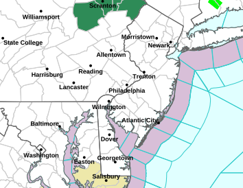
Currently have a snow shower moving through Burlington, NJ.... Expect some snow showers over the next hour or two in the area...
Maybe a sign from mother nature saying "Don't worry, I haven't forgotten about you"
Maybe a sign from mother nature saying "Don't worry, I haven't forgotten about you"
Here Today, Gone Tomorrow
has been the story of the weather model longer range threats so far here at the conclusion of 2011. The other day we were talking about one run on the Euro model that depicted a good sized snow storm for the 3rd and 4th of January. That modeling has come and gone, and we are back to our pattern we have had for the past two months.
This time though, we look to have a couple nice days coming up this week and weekend before a cold front moves through next Monday. This cold front, has been on consistent runs of the Euro and GFS models. The frontal passage will lead to the coldest air of the season, and more than likely, the longest duration so far. Nighttime lows will be in the teens and highs will be in the low 30's. This would be for the period of Tuesday-Thursday.
While it will be nice and then cold, our chances of precipitation, as modeled, is scarce. There will be a couple passing clippers to our north, but for the most part, we will be dry. Our storm that was showing up for Tuesday and Wednesday is still modeled, just way out in the Atlantic where it will not effect us.
Tuesday, December 27, 2011
Another Nice Squall Line Moving Through
Maybe some of you noticed the temperature spike this evening, where it felt more like June than December.... Possibly aided in the development of another squall line poised to move through! Heavy rains, strong winds can be expected over the next 20-30 mins
January 3/4
Euro midday model run paints a raging snowstorm for the I95 cities and the NW Burbs for next Tuesday into Wednesday.
The problem is the pattern sucks for snow, its 8 days out, and it is a perfect track......so, we need to maintain this for approximately another 192 hours. The models have been doing this for recent storms too, so while its nice to look at, chances of this actually occurring are minute.
Keep your fingers crossed....
Warning Simulator
This is a pretty cool site by the National Weather Service.
Have you ever wondered what its like to be the one issuing Warnings? Here is a simulator with a bunch of different situations. Its up to you to issue warnings....
http://www.srh.noaa.gov/ffc/?n=hotseatstart
Have you ever wondered what its like to be the one issuing Warnings? Here is a simulator with a bunch of different situations. Its up to you to issue warnings....
http://www.srh.noaa.gov/ffc/?n=hotseatstart
Monday, December 26, 2011
SNOW DROUGHT TO CONTINUE
Horrible does not even begin to describe this weather pattern. Tough to imagine that we can sit here days away from the end of 2011 and say, with conviction, that our greatest snowfall at the end of the year will have come prior to Halloween! Since then, we have had above normal temperatures and lots of rain. Even when it does get cold, it doesn't last for more than two days before we get a warm up and more rain! Frustrating to say the least.
And, things dont look to be changing anytime soon. Through the New Year we look to continue with the above average temperatures and no snow. There is a potential showing up for the period of January 2-3. As you may be aware, the Winter Classic outdoor hockey game is taking place in Philly this year on January 2nd. It would be neat to have that in a raging snowstorm as opposed to the 50 degrees and rain like they had last year in Pittsburgh!
Anyways, the boring stretch continues!
I hope everyone had a great Holiday, and are looking forward to the New Year!
Thursday, December 22, 2011
Lots O' Rain Moving In
Lots of rain moving into the area. Expect amounts upwards of an inch overnight. Rain dies down tomorrow morning and should be out of here by tomorrow night. After the rain departs, expect the mild temperatures from the past two days to give way to much more seasonable temperatures. Temperatures over the next few days after Friday will be in the 40's with lows in the lower 30's


Wednesday, December 21, 2011
Wild Ride

chance to even hear some thunder tonight! Lines of storms are
developing and moving though Western PA. Don't be surprised to hear a
couple rumbles tonight!
International Space Station

Check out the aurora over Canada!
Midday Model Runs
Looks more wet than white....
For the 23rd into the 24th, fairly common agreement the area is prone to see rain, and some will be heavy. Areas in far NW NJ and Catskill Region of NY to the northern half of CT will likely see some snow, with a small accumulation possible.
After that, it appears Christmas will be cool and dry. The GFS, which was showing the storm this morning has backed off that idea, and the Euro is off the storm train too.
More to come if things change....as of now, expect rain Friday to Saturday, locally heavy....those areas I mentioned earlier will mix with and possibly transition to snow later Friday into Saturday.
Last Day Of Autumn!
The end of Autumn is here! Tomorrow starts the beginning of Winter. It has felt anything like the start of winter, and that really looks to continue. We are in a horrible pattern to lock in any cold air let alone have any snow. Chances will still be there, but for the upcoming holiday season, it looks like it will remain mostly wet. Thursday-Friday will feature some rain. Moving towards the weekend holiday there was a storm showing up on the Euro model, which was a thread the needle storm to begin with, and last nights midnight run showed little precipitation. Now, is this a hiccup or is it ingesting bad data? You can look at other models to find that answer. The GFS model was showing no storm at all this week and had it sliding off the SE coast. This morning, the early morning run shows a storm coming up from the Gulf of Mexico and riding up the coast hitting the area later in the day Christmas Day. Now, whats the reason for the changes? We will have to wait and see for the subsequent runs and see whats going on.
Usually a storm coming out of the Gulf of Mexico would be a good thing, but going back to the pattern, it would support a fast moving storm that would be in and out in no time. Still, any snow on Christmas day would be cool to see.
In any case, uncertainty lays ahead. More to come!
Happy Hanukkah to all my Jewish followers!
Monday, December 19, 2011
Euro Model
I have not seen it yet for myself, but hearing the Euro models midday
run shows a decent snow storm for Jersey on Christmas Day
run shows a decent snow storm for Jersey on Christmas Day
Of course, at this point, I would rather it show that on Saturday than
today.... Something to track
Active Period Upcoming
Well, the scuttlebutt has began about the next two weeks being a
fairly active period, but can this translate into snow? Well, a couple
shots are showing up on the models at least keeping some hope alive.
We are still in a period of not optimal conditions for snow, but
strange things happen leaving the door open.
fairly active period, but can this translate into snow? Well, a couple
shots are showing up on the models at least keeping some hope alive.
We are still in a period of not optimal conditions for snow, but
strange things happen leaving the door open.
Our first shot comes during the middle of the week with a lakes cutter
which will most likely bring us rain, maybe some front end snow. The
second shot, looks to come in Christmas Eve. Yes, Christmas eve. I am
going to leave it at that, because between now and then things will
change every model run on the specifics. There are also some shots
showing up between Christmas and New Years.
The main thing to take away now is that some chances are coming....
Although not optimal, things do happen
Saturday, December 17, 2011
Snow Showers
Just drove through a snow shower down in Deptford New Jersey look out
for snow showers this evening! Finally making it seem like it's a
holiday!
for snow showers this evening! Finally making it seem like it's a
holiday!
Thursday, December 8, 2011
IMPRESSIVE!

960mb low pressure is equivalent to the Superstorm of 93' and numerous
major hurricanes. They are supposed to be getting a second storm too
in a couple days.... Crazy!
Thank You!
As of yesterday, my blog has gone over the 12,000 hits mark....thank you to all that read, and especially the guy sitting at home who keeps clicking my link :)
Thank you again though, 12,000 is a number I would never have dreamed about!
We are in a horrendous pattern for snow, but there are some changes coming. Even in this terrible pattern, we were almost able to pull out a snow event (missed us by about 60 miles). Starting this week, it will "feel" much more like winter (highs in the 40's and lows in the lower 30's). Hopefully by the end of the month or start of January we can get back into a snowier pattern!
Wednesday, December 7, 2011
Flood Warnings
Flood Warnings going out all over the place. Numerous reports of flash floods in DC, where a number of water rescues had to be performed. Be careful driving.
Snow line has made it past Harrisburg, PA and is through the Pocono Region of PA.
Snow line has made it past Harrisburg, PA and is through the Pocono Region of PA.
12/7/11 Update
Numerous reports of thunderstorms now being reported in Lancaster and Harrisburg, PA. Radar echo returns are getting really intense in the S Jersey and Delaware regions.
Now and the overnight, extremely heavy rains will continue to fall over the region. Snow will try and work in early morning tomorrow.

Now and the overnight, extremely heavy rains will continue to fall over the region. Snow will try and work in early morning tomorrow.

December 7/8 update
Heavy Rain to continue overnight and possibly end as some snow tomorrow morning. I am not expecting any accumulation. Temperatures here are still in the mid 50's, temps in central PA are already crashing through the 30's. State College, PA has changed over to snow. The rain/snow line will slowly make its way to the east overnight.
More to come
More to come
Tuesday, December 6, 2011
Storm threat taking shape
Our storm threat is taking shape over Louisiana now, and snow has been
reported in Shreveport over the last hour.
reported in Shreveport over the last hour.
Tuesday Afternoon Update for Wednesday-Thur
Winter storm watches going up for the Poconos.....and flood watches going up for Philly Metro.
Tuesday Noon Wed-Thurs Update
Midday model runs are in and it appears our storm is going to head even closer to our area. This would mean an extended period of cold rain and maybe a transition to snow on the backside. We will see how they react this afternoon and evening.
More to come
More to come
Tuesday Morning update on Wed-Thurs Threat
overnight and early morning model runs bring our storm a push further west, meaning we start of with a good dose of rain and then transitions to snow as cold air wraps in.
Until then, we are going to be under the influence of a frontal boundary that will keep us cloudy and showery, and quite mild. A low pressure system will form off the NC coast Wednesday afternoon and will strengthen and move NE. As with these types of systems, the exact track and strength determines our weather.
More to come
Monday, December 5, 2011
Wednesday Thursday 00z NAM
The night time run of the NAM model is in and shows a very nice inland
snowstorm. For us, verbatim, would be rain to a brief period of heavy
snow.... Still a developing situation and plenty of wiggle time...
Let's see how the other models do tonight!
snowstorm. For us, verbatim, would be rain to a brief period of heavy
snow.... Still a developing situation and plenty of wiggle time...
Let's see how the other models do tonight!
Wednesday Thursday Threat Update
The American NAM model has remained consistent all day with its runs of the threat for Wednesday and Thursday. The GFS model, which was out to sea this morning has brought the threat a little closer to the coast, but not as close as the NAM. Temperatures are looking to be borderline for this storm, but, as we learned during Halloween, sometimes snow happens.... even in the not so ideal setups.
Again, we would be looking at a primarily small event, 1-3; 2-4 type deal (if all holds serve)
More to come!
Again, we would be looking at a primarily small event, 1-3; 2-4 type deal (if all holds serve)
More to come!
Wednesday Thursday Threat
The threat still is showing up on model guidance. The GFS model who was showing an bigger impact yesterday, has been a little more suppressed and takes a more out to sea track. The NAM model (shorter range) showed this morning a moderate event that will leave a stripe of precipitation from WV through NJ.
In any case, it does not look like a huge event, although there is a chance of seeing some snow. More to come, and hopefully we can build some model consensus over the next few days.
In any case, it does not look like a huge event, although there is a chance of seeing some snow. More to come, and hopefully we can build some model consensus over the next few days.
Sunday, December 4, 2011
Early December Storm Threat
here we go...... time to get the storm talk going!
Looks like central NJ is looking at its first snow chance since Halloween. The time period from Wednesday and Thursday looks to be the threat period. This will once again be a coastal redevelopment system that will track off the NC/VA border up the coast. More to come on this!
Looks like central NJ is looking at its first snow chance since Halloween. The time period from Wednesday and Thursday looks to be the threat period. This will once again be a coastal redevelopment system that will track off the NC/VA border up the coast. More to come on this!
Subscribe to:
Posts (Atom)