Tuesday, January 29, 2013

Roller Coaster Continues 1/29/2013 Morning Update

Well, the warm front has pushed through the area. As a result, we will have a nice thaw for today and tomorrow. Today, highs are looking like we will hit the high 40's to low 50's. Tomorrow, we have a serious shot of 60 degrees. In addition, I am becoming more and more concerned about a severe weather outbreak tomorrow. The severe outbreak is attributed to a strong cold front which is currently marching through the midwest. This front is going to spawn severe weather over the Northern Gulf States. These areas are going to have a rather impressive chance for tornadoes and very strong winds . As shown, the Storms Prediction Center is all over this:

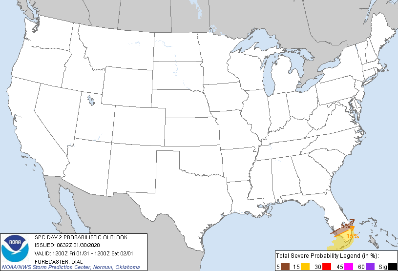
Severe Weather Potential:
Tornadoes:
Winds:

As the front marches eastward, this area will move east. The front will bring very strong winds just off the ground and any storm that can gain some elevation can tap into these winds and mix them down to the surface. This will have to be watched to see how the severe weather plays out today and what that can lead to in 24 hours. SPC sees the threat for tomorrow, but not as pronounced. This may increase depending on how today's events go:


Once this storm pushes through, it will usher in cooler air once again. From there, hopefully we can get some kind of calibration to our winter and allow for some snow to make its way into the snow starved areas in NJ.

No comments:

Post a Comment