TORNADO WATCH OUTLINE UPDATE FOR WT 543
NWS STORM PREDICTION CENTER NORMAN OK
900 AM EDT MON OCT 7 2013

TORNADO WATCH 543 IS IN EFFECT UNTIL 500 PM EDT FOR THE
 FOLLOWING LOCATIONS

NJC001-003-005-007-009-011-013-015-017-019-021-023-025-027-029-
031-033-035-037-039-041-072100-
/O.NEW.KWNS.TO.A.0543.131007T1300Z-131007T2100Z/

NJ
.    NEW JERSEY COUNTIES INCLUDED ARE

ATLANTIC             BERGEN              BURLINGTON
CAMDEN               CAPE MAY            CUMBERLAND
EASTERN UNION        ESSEX               GLOUCESTER
HUDSON               HUNTERDON           MERCER
MIDDLESEX            MONMOUTH            MORRIS
OCEAN                PASSAIC             SALEM
SOMERSET             SUSSEX              WARREN
$$
Finally, we will be able to push this warm and humid airmass out of here today. A cold front is pushing east today and will bring with it much relief from the humid airmass. Along with the frontal passage, will be heavy rains, winds and isolated tornadoes. Once the front passes through, we will once again have temperatures in the low 70's with low humidity!
A vigorous disturbance moves in tomorrow bringing more flooding rains. This time though, this will be accompanied by severe weather. Heavy rains will blanket the area, although more may fall north from NNJ/NYC through New England. 2-4" will be a good bet up there. Further south, we are looking at another 1-2" but will take the brunt of the severe weather. Heavy rains, dangerous lightning, strong winds, hail and even a tornado threat will be present. I will have more to come on this in a more detailed post this evening. Tomorrow is looking nasty!
As many of you know, Tropical Storm Andrea was born yesterday, but not really. Andrea started off in the Pacific ocean and actually hit Mexico about a week ago. her Pacific name was Barbara and was classified as a Cat 1 Hurricane just prior to landfall. Since then, she moved across Mexico and into the Gulf of Mexico. From there, she meandered north and officially became a Tropical Storm yesterday after the US Air Forces' Hurricane Hunters flew into the storm to better sample her energy. What they found was enough to warrant the naming of the storm. its rare for a storm to move from the Pacific to the Atlantic, but Barbara / Andrea is one of the few. Her name would have changed regardless even if she had not fallen below naming criteria in the Gulf of Mexico.
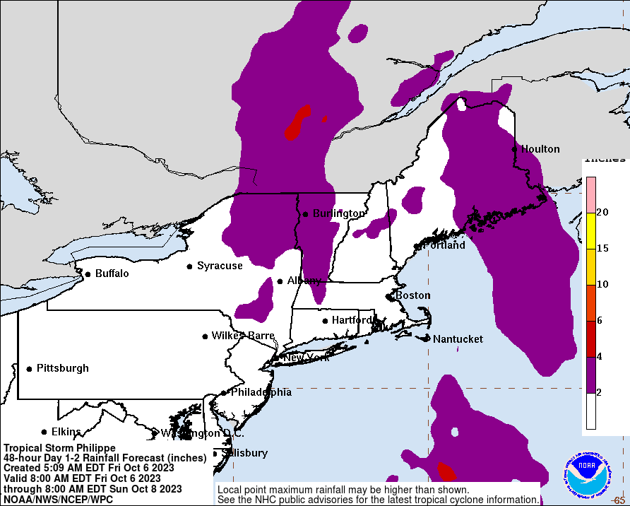
Currently, Andrea is ready to make landfall into Florida. From there she will track across Florida and up the eastern seaboard. Andrea is currently packing 60mph winds, heavy rains and even some tornadoes. Flash Flood Watches have already been posted in parts of the area (although not NJ yet). The biggest impacts for us will be rain. Andrea will pass to our east. You can remember from storms of the past, that the most severe weather is usually located on the eastern side, so that will be out over the ocean. We will however have copious amounts of rain. We are looking at potentially 2-4" of rain. Winds will be present, but for the most part will not be very significant.
Rain moves in tonight and will last through late Friday Night. Showers may stick around for a period of time Saturday morning. The heaviest rains will fall during the day on Friday. As usual, updates on twitter and facebook. Welcome to the tropical weather season!
Last week, I spent some time writing some thoughts of the Weather Channels' Mike Bettes being involved in an accident where he and his crew were knocked off the road by a tornado. Mike Bettes is best known has an on-air personality on the Weather Channel. In an attempt to harness some ratings, Mike was put out into a tornado, representing the Weather Channel. Cameras rolling, we were able to get live reports once again from the ever increasing phenomenon of "extreme weather." The Weather Channel has gotten into this over the past decade or so. They send parts of their team to the areas of big weather events. We have seen it for hurricanes, winter storms, wildfires and now tornadoes. Each time, seemingly getting more dangerous, the audience is kept in awe over the live feeds. The willingness of people to watch, drives the market and heightens the dangers as more and more compete for the ratings. I said my piece on the Weather Channel and their close call with a tornado two days ago here: Weather Channel Rant (click)
Here is Mike and his crew's car:
The other side of the media hype for ratings is the scientific side. Storm Chasers actually chase storms for a purpose. There are chasers out there to learn more about storms, lightening, tornadoes, hail, winds etc etc. This information that is collected will hopefully be able to help predict, model, and interpret severe weather so that storms can be better predicted, warning times can increase and lives can be saved......lives being saved. While we get caught up in the adrenaline rush of seeing these live feeds of those out seeking a thrill, there are those there with a purpose.
Yesterday morning, I learned of the death of Tim Samaras, Paul Samaras (Tims son) and Carl Young. For many, the names will not sound familiar. For those that know, one of the greats was lost. I first started following Tim, like many, watching Discovery Channels "StormChasers" show. This is also where I started following Reed Timmer and Sean Casey. While Reed and Sean both had the cool cars ( Dominator and TIV) which resembled tanks rather than cars, it was Tim who had the White Truck with the cargo door in the back. Reed and Sean both try and get into the tornadoes path and try to intercept for their research. Tim and his crew would get into the path, drop some probes and get out of the way. Reed and Sean were the adrenaline pumpers and Tim was just kinda that guy who was there for the research and was the filler between Reed and Sean. Tim was always the cautious one, playing it safe, always leaving an escape route in case something out of the blue happened. He was the one who preached safe practices and limited his risk as much as he could. He was there to research tornadoes and hail. He had some groundbreaking research that has yet to be released. His contributions to the field were astronomical and we will learn more about his research in the years to come. On Friday, while deployed for a tornado in El Reno, OK Tim, his son, Paul, and long time co worker Carl were swept off the highway and killed. In this tornado, there was 16 people killed all together. Another death along the highway involved is a mother and her child.
Tims truck:
Yes, saving lives is a good thing. Countless times the story is the same; tornado comes, areas are devastated and there is always a fatality count. More and more though, we are finding lower and lower deaths. This could be directly related to the good that storm chasing brings. The countless research probes launched, the cameras, etc etc. We have learned a lot from the people willing to risk it all for research, and there remains a lot more to learn. Hopefully as time goes on, we can improve warnings and forecasts and more lives can be saved.
So, a Weather Channel crew was "chasing" a tornado today and was a little to close, in a vehicle totally not able to withstand any significant tornado. Thankfully, word is all are ok...... What a bunch of maroons. First, its the Torcon scale, then its naming winter storms, and now, we just throw our people infront of tornadoes in vehicles not equipped to protect them. Stay classy Weather Channel. Anything for ratings right?
Its a shame they felt the need to do this and now place a black mark on the rest of the field trying to perform intercepts, in proper vehicles designed to withstand a tornado. The rest of the field trying to obtain scientific data to make a difference in the knowledge we know about tornadoes. This knowledge would allow a better understanding of tornadoes and allow for better warning, which could save lives.
And now, we take the arguably most visible weather source and put guys in a car and act like total morons. Its dangerous and idiotic. Stay Classy Weather Channel. SMH!
***FLASH FLOOD WATCHES POSTED FOR THE AREA*** ***HIGH WIND WARNINGS POSTED FOR COASTAL AREAS*** FRONTAL PASSAGE LOOKS TO PASS BETWEEN 11PM AND 2AM.
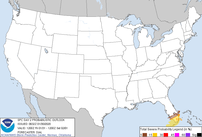
Well, if yesterday is any indication of whats coming, we should be in for quite the wild night. 14 Tornado watches issued yesterday, numerous reported tornadoes and other severe weather outbreaks. Continuing this morning, tornado warnings have already been issued for parts of Georgia. This threat will continue. The Storm Prediction Center has been all over this, and they continue with their forecasts for today. They have actually extended their area of severe weather up into our area as designated as the slight risk on their map. A slight risk into these parts in January is quite odd. Anyways, here are their maps:
OUTLOOK:
TORNADO:
WINDS:
So, as you can see, our area (NJ) has been placed in a number of these categories. This is a vigorous cold front coming through and with temperatures getting up into the 60's today (already 65 in Buffalo, NY!!!), there will be some fuel. There are also extremely strong winds above the surface of the earth and any storm that can gain some elevation can get these winds to mix down. I think our primary threat will be strong winds with the frontal passage. We will also have some heavy rain, so much so that a Flash Flood Watch was issued for the area for 1"-2.5" of rain. That much rain falling quickly can lead to quick flooding conditions.
The frontal passage has been pushed back a little, due to it really becoming a slow mover. Originally I was looking for a late afternoon / evening start, but it appears now, that it will pass between 11pm and 2am. For many of you, you will be asleep and will probably be woken up by the winds, rain and possible thunder.
There will be more to come, so stay tuned to twitter @townerswxpage and facebook Towner's Weather PAGE
Well, the warm front has pushed through the area. As a result, we will have a nice thaw for today and tomorrow. Today, highs are looking like we will hit the high 40's to low 50's. Tomorrow, we have a serious shot of 60 degrees. In addition, I am becoming more and more concerned about a severe weather outbreak tomorrow. The severe outbreak is attributed to a strong cold front which is currently marching through the midwest. This front is going to spawn severe weather over the Northern Gulf States. These areas are going to have a rather impressive chance for tornadoes and very strong winds . As shown, the Storms Prediction Center is all over this:
Severe Weather Potential:
Tornadoes:
Winds:
As the front marches eastward, this area will move east. The front will bring very strong winds just off the ground and any storm that can gain some elevation can tap into these winds and mix them down to the surface. This will have to be watched to see how the severe weather plays out today and what that can lead to in 24 hours. SPC sees the threat for tomorrow, but not as pronounced. This may increase depending on how today's events go:
Once this storm pushes through, it will usher in cooler air once again. From there, hopefully we can get some kind of calibration to our winter and allow for some snow to make its way into the snow starved areas in NJ.