Models today have continued the general theme of a snowy Tuesday for the PHL - NYC corridor. All guidance is showing a plowable event for the area. Another common theme among the models is the formation of a rather robust band of snow. While this band of snow is showing up on models, and will be a driving force to greater accumulations, it will be something that will have to be nowcasted tomorrow closer to the event. Where this band sets up will be the "winners" in the snow accumulation. As of now, this line is forecasted per guidance to setup over our area. This is the reason why the Delaware River locations from PHL to Trenton is in a warning and not an advisory like the rest of the area. Needless to say, it will have to be something that I will be watching tomorrow. While the forecast is saying 4-6" for the area, if we do not end up under the band, we will probably have advisory level snows (2-4"). After the snows from yesterday, we can see what kind of accumulations you can get under one of those bands. Wilmington, DE to PHL to Southern NJ had a broad area of 6-10" of snow under that band that broke out. The moral of the story here is, we will have a general area of 2-4" snows, but getting hit by one of the bands of snow will increase those amounts, and that will have to be nowcasted tomorrow. In any event, precipitation type should not be a question. It will be getting colder as the storm progresses (as another round of cold pushes in) so we are looking at a solid snow event. This will be the type of snow that will stick around through the night and cause travel headaches since it will be blowing around and minimal melting will take place (sans areas that are treated). Start time looks like mid to late morning through the area. It will start from the SW and move NE. It will be a quick hitter and more than likely be winding down by the evening.
As always, more to come via twitter and facebook!
Showing posts with label advisory. Show all posts
Showing posts with label advisory. Show all posts
Monday, December 9, 2013


Sunday, February 10, 2013
Freezing Rain Advisory, Mercer and NW Counties
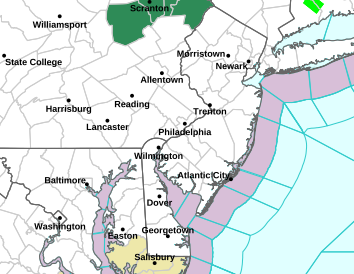
the NWS has issued freezing rain advisories for areas NW of Mercer and Northern Bucks Counties. Please be careful if driving through tomorrow am. Temperatures will rise tomorrow and everyone will go over to rain.

Monday, February 4, 2013
Another Clipper Moves Through Tonight
Well, for the third straight night, we will have another clipper moving through. Currently, the clipper is moving through Chicago and Indiana and will be making a drive east to the coast. I like our chances here to see a couple inches in Central NJ. We are in a great spot as it relates to clippers. The low pressure associated with the clipper will move just to our south. Usually, a path from the low out about 75-100 miles on either side is prime for the highest accumulations with a clipper. We are sitting within that (as modeled). The NAM model would bring us 2-3" while the GFS is more of a C-2" I would expect Advisories to be issued again for the overnight.
There may be another shot at a weak disturbance moving through Wednesday morning, and then I think clippermania comes to a stop. Our weather may get pretty boring for a couple days. After that, we will have to monitor and see what kind of storm tracks set up. Friday is looking interesting. the EURO model has shown for three consecutive runs and storm off the Carolina Coast which phases and comes up the east coast. The GFS has this too, but doesn't phase, and it just scoots off the Carolina Coast. The Euro has been horrible of late, but nonetheless I will be watching it.
Snow looks to start 11pm-1am tonight and may last for a couple hours into the morning commute. Temperatures will be cold in the 20's.
There may be another shot at a weak disturbance moving through Wednesday morning, and then I think clippermania comes to a stop. Our weather may get pretty boring for a couple days. After that, we will have to monitor and see what kind of storm tracks set up. Friday is looking interesting. the EURO model has shown for three consecutive runs and storm off the Carolina Coast which phases and comes up the east coast. The GFS has this too, but doesn't phase, and it just scoots off the Carolina Coast. The Euro has been horrible of late, but nonetheless I will be watching it.
Snow looks to start 11pm-1am tonight and may last for a couple hours into the morning commute. Temperatures will be cold in the 20's.
Saturday, February 2, 2013
Winter Weather Advisories Issued Central NJ
...WINTER WEATHER ADVISORY IN EFFECT FROM 7 PM THIS EVENING TO 1 PM EST SUNDAY...
THE NATIONAL WEATHER SERVICE IN MOUNT HOLLY HAS ISSUED A WINTER WEATHER ADVISORY FOR SNOW...WHICH IS IN EFFECT FROM 7 PM THIS EVENING TO 1 PM EST SUNDAY. * LOCATIONS...PORTIONS OF SOUTHEAST PENNSYLVANIA...AS WELL AS PARTS OF CENTRAL AND SOUTHERN NEW JERSEY. * HAZARD TYPES...SNOW * ACCUMULATIONS...SNOW ACCUMULATION OF 1 TO 3 INCHES...WITH THE HIGHEST AMOUNTS IN MERCER COUNTY NEW JERSEY. * TIMING...LIGHT SNOW WILL OVERSPREAD THE REGION EARLY THIS EVENING...THEN BECOME STEADIER LATE THIS EVENING THROUGH THE OVERNIGHT HOURS INTO SUNDAY MORNING. THE SNOW WILL BECOME MORE INTERMITTENT EARLY SUNDAY AFTERNOON. * IMPACTS...UNTREATED DRIVING AND WALKING SURFACES WILL BECOME SNOW COVERED AND SLICK. THIS COULD LEAD TO LOCALLY HAZARDOUS DRIVING CONDITIONS. * WINDS...SOUTHWEST 5 TO 10 MPH. * TEMPERATURES...IN THE UPPER 20S.
THE NATIONAL WEATHER SERVICE IN MOUNT HOLLY HAS ISSUED A WINTER WEATHER ADVISORY FOR SNOW...WHICH IS IN EFFECT FROM 7 PM THIS EVENING TO 1 PM EST SUNDAY. * LOCATIONS...PORTIONS OF SOUTHEAST PENNSYLVANIA...AS WELL AS PARTS OF CENTRAL AND SOUTHERN NEW JERSEY. * HAZARD TYPES...SNOW * ACCUMULATIONS...SNOW ACCUMULATION OF 1 TO 3 INCHES...WITH THE HIGHEST AMOUNTS IN MERCER COUNTY NEW JERSEY. * TIMING...LIGHT SNOW WILL OVERSPREAD THE REGION EARLY THIS EVENING...THEN BECOME STEADIER LATE THIS EVENING THROUGH THE OVERNIGHT HOURS INTO SUNDAY MORNING. THE SNOW WILL BECOME MORE INTERMITTENT EARLY SUNDAY AFTERNOON. * IMPACTS...UNTREATED DRIVING AND WALKING SURFACES WILL BECOME SNOW COVERED AND SLICK. THIS COULD LEAD TO LOCALLY HAZARDOUS DRIVING CONDITIONS. * WINDS...SOUTHWEST 5 TO 10 MPH. * TEMPERATURES...IN THE UPPER 20S.
Subscribe to:
Posts (Atom)