Oh boy, lots of news now.
First things first, Sandy is now a hurricane. Sandy is packing 80mph winds and is currently making landfall in Jamaica. She will move up and through Cuba tonight and then take aim at the Bahamas Thursday Night into Friday. From there is where the real fun will begin. Here is the projected track as of 11am today:
Now, on this page, you can already see that this track is further west then it has been over the past couple days. I have already talked about the impulse in the area of Alaska that will cause the ridging out west (which creates the trough in the east). The trough in the east will allow the storm to ride along it, and eventually phase in with the arctic jet. When this phase occurs, this will be the driving force to "pulling" the storm westward to the coast.
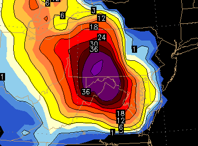
The Euro model has been deadly consistent over the past three days (6 model runs) of showing very consistent outcomes. it has been showing a monster hit in the area (all bringing a bad scenario to those of us in Jersey.) last nights run was probably the worst run Jersey could potentially experience with this storm.) It brought Sandy up the east coast, effecting the major cities and then when the phase took place, Sandy made an immediate left turn into Jersey. Here is the model run showing the scenario:
Monday Early Morning:
Tuesday Early Morning: (making left into Jersey)
And finally, Wednesday morning, over Philly:
no need to explain the outcome here, it would be devastating. strong winds, massive amounts of rain, widespread power outages etc etc. The Euro has been showing an East Coast impact for like I said, 3 straight days (6 model runs). Its on to something.
I have talked a lot about the GFS model and how 4 days ago, it showed a similar hit, only to take it out to sea and bother Bermuda. Over the past three days, it has taken small steps back towards the Euro solution. It has tried to show what would happen if Sandy was not able to phase, and the ridge out west was not as strong, and a progressive pattern would just let the storm escape out to sea. The scary part is, over the past couple days, the model has begun to recognize all the players on the field. This is why a move towards the EURO solution is troublesome because now it really enforces the idea this can happen. So, todays midday run of the GFS model has brought the storm back to effecting the east coast, and actually makes landfall in Maine. So, we can see it is recognizing the players, and adjusting accordingly. I believe it will continue to do this and move towards the EURO.
When a model runs, it is made up of a number of subsets that take into account a number of different variables. These ensemble runs make up the operational run. the operational run is kind of a medium of all the ensemble members of the model. Well, whats interesting is, over the past few days, we had a large majority of the ensemble members taking the track well off shore and out to sea. Over the past few days, many of the ensemble members have began to switch over to a more coastal track. Each run, the more members went further west to where we are now. Even as this operational run of the GFS took Sandy to Maine, many of the ensemble members are continuing to show a more westward track. For this reason, I am not going to be shocked to again think that this will move even further west.
So, bottom line, models are really starting to show the real potential here with a devastating storm that is taking aim on the east coast. There will be plenty more updates to come. Please continue to monitor the National Weather Service for further updates. i will also be passing all those along and then some on both my twitter (@townerswxpage) and on my facebook page (Towners Weather PAGE). Please share with friends and let them know. I try and keep updates throughout the day and let you know things as soon as I do.