Monday, October 22, 2012

Halloween Update

I started talking about a potential storm for next week last night. The evening run of the GFS was the first to show a further east solution, which it still has, but the EURO model has remained fairly consistent with its track. Here is the morning update. Euro still shows a major storm, and the GFS is out to sea.

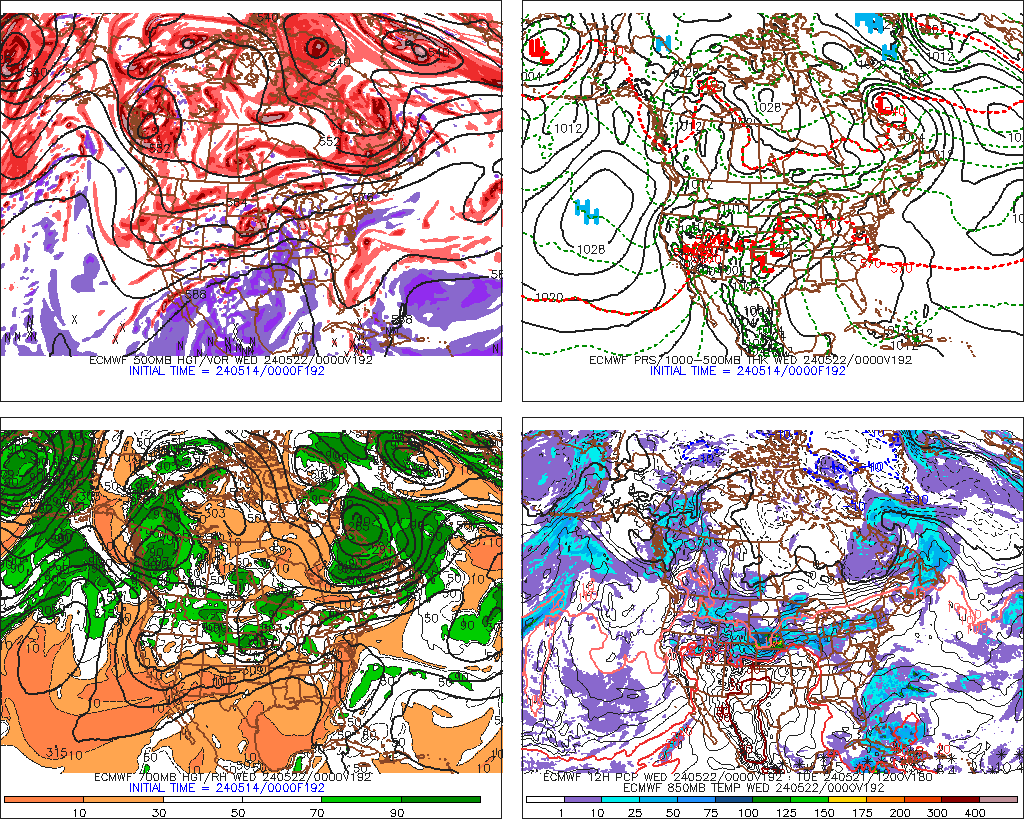
Here is the midnight run of the EURO at 192hrs:

and 216 hrs:

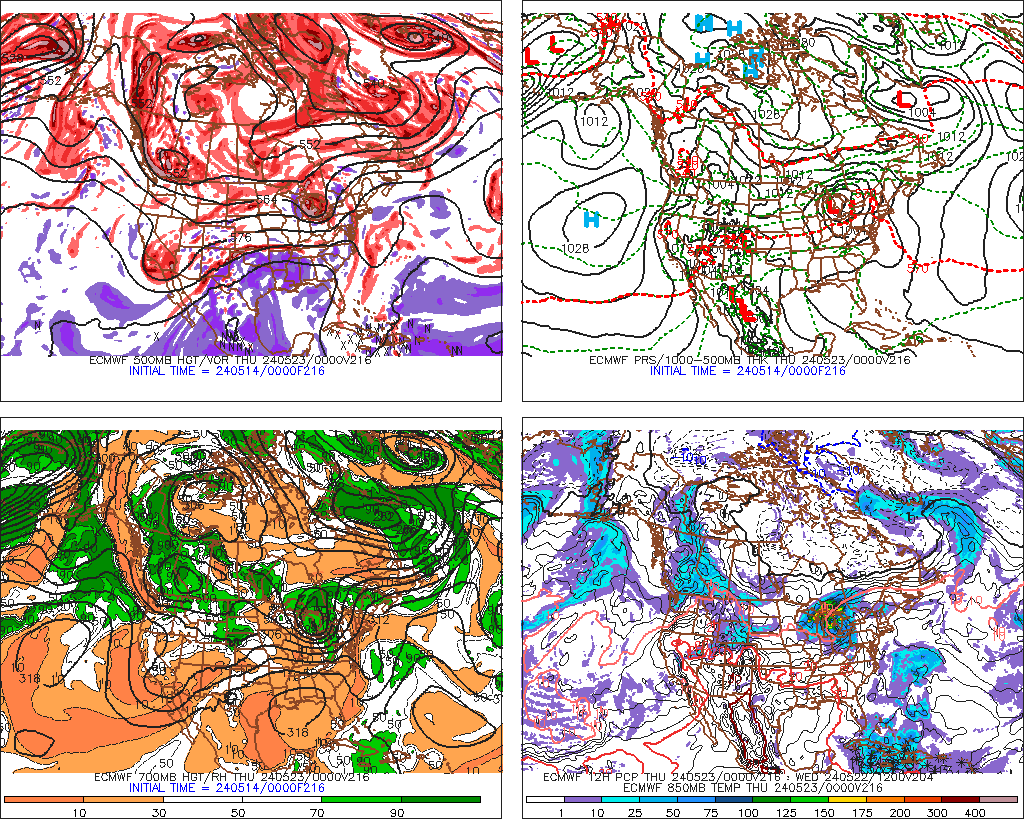
one thing about this run, it shows a large storm, and really brings down some cold air all the way down to the Gulf States.

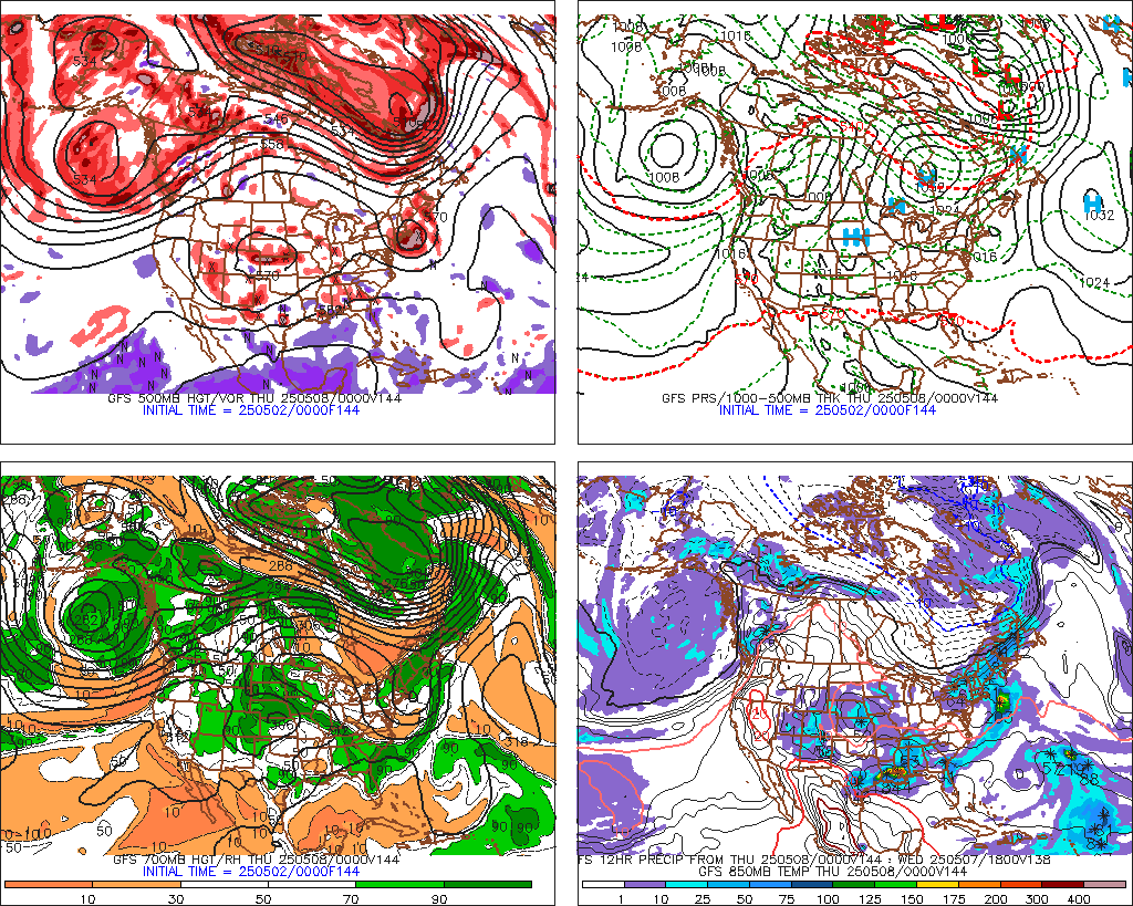
The GFS model, depicted here at 144 hrs has the storm, but then moves it East and out to sea:

more to come.


No comments:

Post a Comment